Home · Roman Verona
Verona's old center still follows its Roman street plan, and an amphitheater, a theater, two gates, a bridge and a buried temple show the city of two thousand years ago.
- 01Porta LeoniA late-republican gate on the cardo, with its Roman street and foundations exposed below today's pavement.
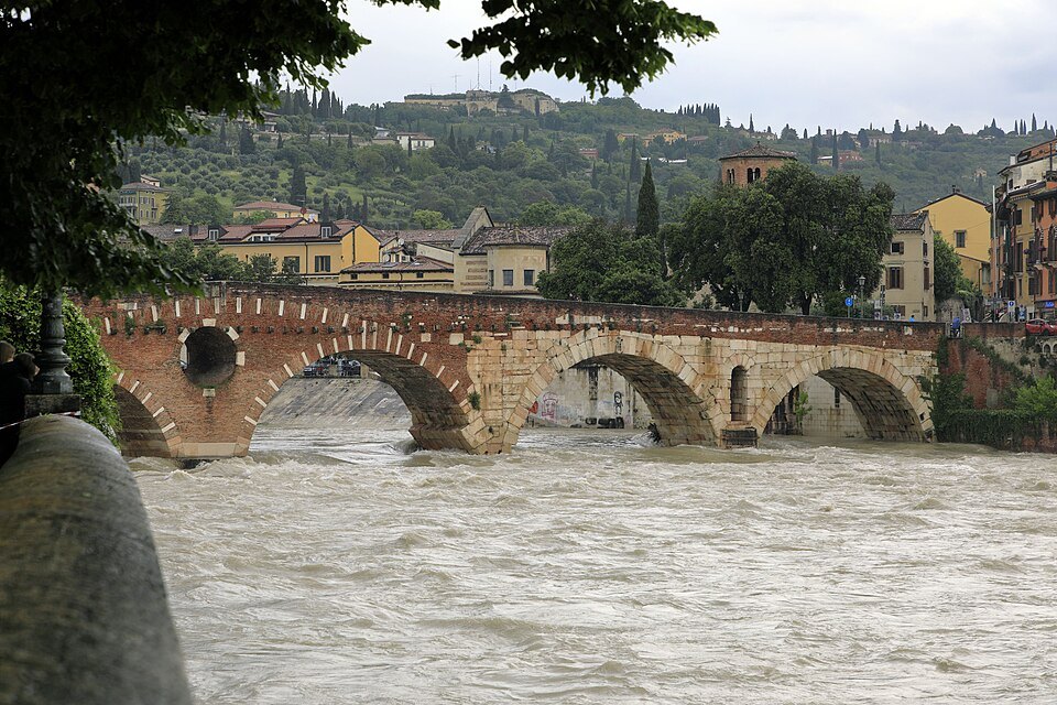
- 02Ponte PietraThe stone bridge of the first century BC that carried the Via Postumia across the Adige.
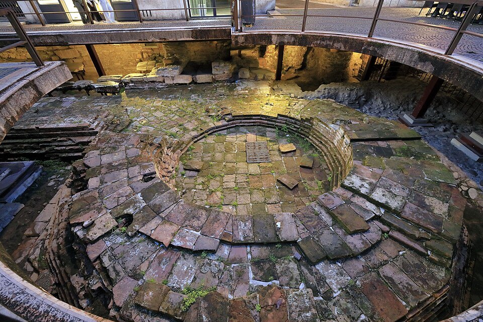
- 03The forum and CapitoliumPiazza delle Erbe covers the forum; the temple's cryptoporticus can be visited under Corte Sgarzerie.
- 04Roman theaterBuilt in the late first century BC on the hill of San Pietro and excavated in the nineteenth century.
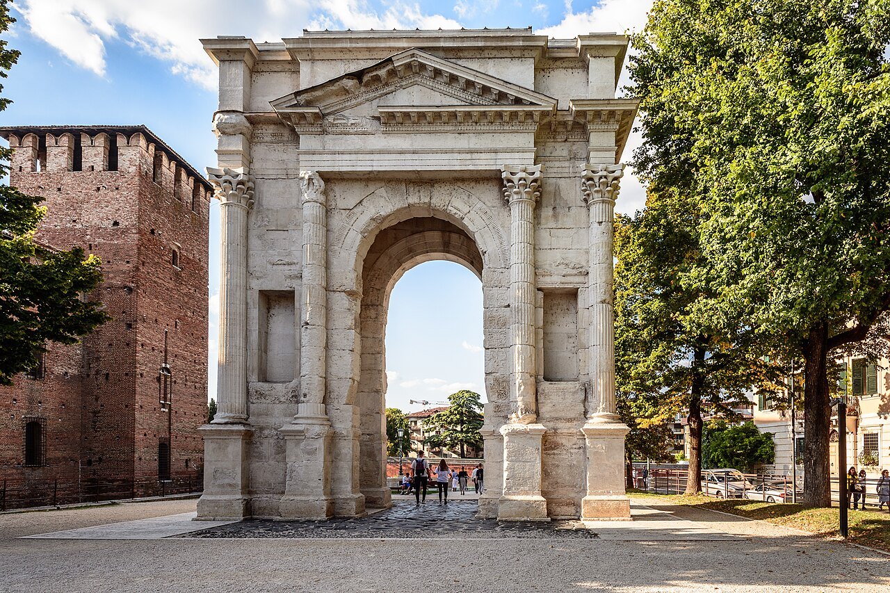
- 05Arco dei GaviA private honorary arch of the early first century AD, demolished in 1805 and rebuilt beside Castelvecchio.
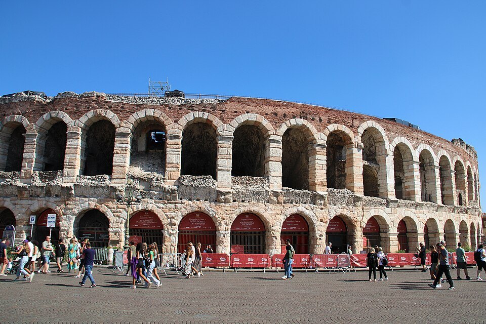
- 06The ArenaThe amphitheater built outside the walls in the first century AD, still used for summer opera.
- 07Porta BorsariThe main gate on the decumanus, with a first-century façade and an inscription from Gallienus' reign.
- 08Walls of GallienusWalls rebuilt in 265 with reused stone, extended to enclose the Arena; fragments survive in the center.
- 09Scavi ScaligeriRoman, Lombard and medieval remains under the courthouse courtyard, used for photography exhibitions.
Laid down in order: the oldest at the foot.
From hill village to Roman town
The first Verona grew on the slopes of the hill of San Pietro, above a bend where the Adige narrows and has always been easiest to cross. Rome took an interest for strategic reasons. The Via Postumia, the road from Genoa to Aquileia, passed beneath the hill, turning the settlement into a junction on one of the great routes of northern Italy.
Verona became a Roman colony in 89 BC, and in 49 BC a municipium, when its people received full Roman citizenship and were enrolled in the tribe Poblilia. Around that time the town was refounded on the flat land inside the loop of the river, south of the hill. The Adige protected it on three sides, so only the southern edge needed walls.
The hill was not abandoned. It was reshaped into a stage set for the new town across the water, with a theater on its lower slopes and terraces climbing to a temple at the top. Two stone bridges tied the two halves together. Much of what a visitor sees today in the center sits on that Roman plan.
The grid and the decumanus
The new town was laid out as a regular grid. Its main east-west street, the decumanus maximus, continued the Via Postumia and survives as Corso Porta Borsari and Corso Sant'Anastasia. The main north-south street, the cardo maximus, is today's line of Via Sant'Egidio, Via Cappello and Via Leoni. Minor streets ran parallel to both, dividing the town into almost square blocks.
The pattern is still clear on an aerial photograph and easy to feel on foot: streets meet at right angles, and the blocks inside the river loop keep their Roman size. The walled area covered about 480,000 square meters, making it one of the larger towns of northern Italy, and the paved streets were about eight meters wide.
The Roman ground level lies well below the modern one, several meters down in places. Many houses and palaces stand on Roman foundations, and their cellars hold walls and pavements that are rarely open to visitors. What can be seen has been exposed deliberately, in a handful of excavations, basements and open pits across the center.
The forum and its temple
Where the cardo and the decumanus crossed lay the forum, the political and commercial heart of the town. Piazza delle Erbe occupies its site. The Roman square was larger and more regular, a long rectangle of about 168 by 56 meters paved in white and pink limestone, with porticoes, the curia where the council met, and a basilica for trade and law courts.
Above the forum stood the Capitolium, the chief temple, dedicated to Jupiter, Juno and Minerva. Begun soon after 49 BC and finished around 20 BC, it rose on a terrace reached by a staircase. A long portico wrapped around it on three sides, carried on a vaulted, half-underground corridor, the cryptoporticus.
Pieces of the complex survive out of sight of the square. Foundations of the temple's front columns can be seen inside Palazzo Maffei. Under the loggia of Corte Sgarzerie, excavations between 1988 and 2004 exposed a section of the cryptoporticus, with pillars and fallen vaulting, the only part of the Capitolium that visitors can enter.
Gates, walls and a bridge
The republican wall had two main gates. Porta Leoni, on the cardo, was built by four named magistrates and later rebuilt in imperial times. Only half of its inner façade stands, set into a medieval building, but the street beside it is an open excavation where the Roman road and the foundations of the gate's courtyard lie a few feet below today's pavement.
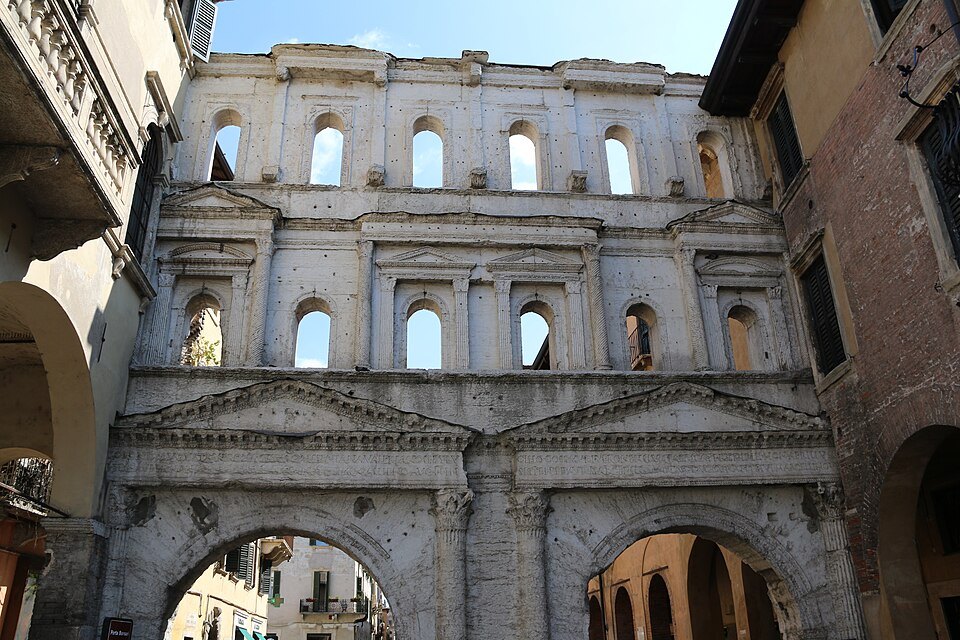
Porta Borsari, on the decumanus, was the town's main entrance, known to the Romans as Porta Iovia. Its white limestone façade, with two arches and rows of arched windows, dates to the first century AD. An inscription from the reign of the emperor Gallienus records a later rebuilding and names the city Colonia Verona Augusta.
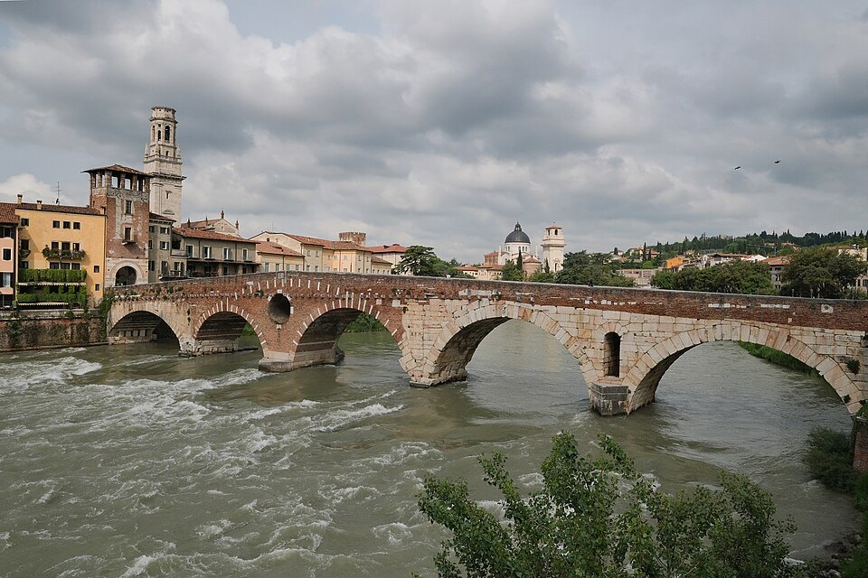
Gallienus also rebuilt the walls, in 265, after Germanic raiders reached northern Italy. The work ran from April to December of that year and reused stone from older buildings, adding a stretch that enclosed the Arena. Ponte Pietra, the stone bridge that carried the Via Postumia over the Adige, is older still, though four of its arches, blown up by retreating German troops in the Second World War, were rebuilt in 1957 from the original stones.
Theater and amphitheater
The Roman theater was built in the late first century BC against the hill of San Pietro, facing the town across the river. In the Middle Ages houses covered it. Between 1834 and 1844 Andrea Monga, a wealthy merchant with a passion for archaeology, bought the land, demolished about thirty houses and excavated. The city bought the site in 1904 and finished uncovering the seating.
Above the theater, three terraces rose to a monumental building, most likely a temple, whose traces were found when Castel San Pietro was built on the summit. The theater is still used for performances each summer, and an archaeological museum occupies the former convent above the seating.
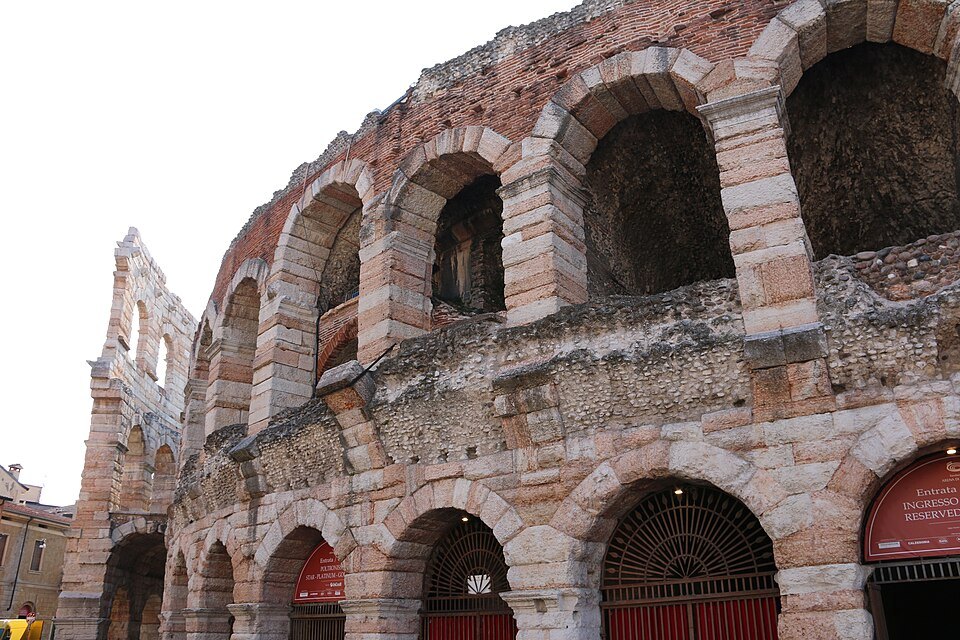
The Arena was built outside the walls in the first century AD; scholars disagree on the exact decade. It measures about 139 by 110 meters. Most of its outer ring was lost, partly dismantled for building stone in late antiquity and damaged by floods and earthquakes, including the great earthquake of 1117, leaving a single fragment, the wing, above the inner façade seen today.
An arch and the finds underground
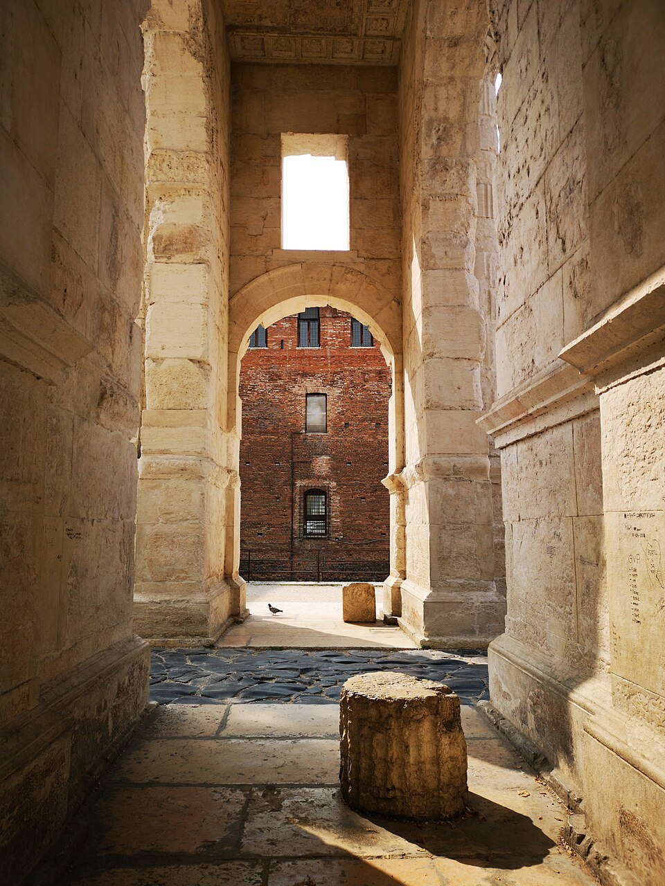
The Arco dei Gavi was a rare thing in Roman architecture: a monumental arch built by a private family, the Gavii, in the first half of the first century AD. It straddled the Via Postumia outside the town, and it carries the signature of its architect, a Vitruvius, carved into the stone. Renaissance architects, Palladio among them, measured and copied it.
French military engineers demolished the arch in 1805. Because it had been drawn so carefully, it could be reassembled in 1932 in the small square beside Castelvecchio, near but not on its original site, where visitors can walk through it.
Under the courthouse courtyard near Piazza dei Signori, excavations between 1981 and 1983 uncovered Roman, Lombard and medieval remains. The site, known as the Scavi Scaligeri, has hosted photography exhibitions among the ruins since 1996, so a visit to a show there is also a walk through several layers of the city.
Walking the Roman town
The simplest way to read Roman Verona is to walk the decumanus. Start at Porta Borsari, follow the Corso to Piazza delle Erbe, detour to Corte Sgarzerie and Palazzo Maffei, then continue along Corso Sant'Anastasia to the river and across Ponte Pietra to the theater. The incline lift from the riverside climbs the hill to Castel San Pietro and its view over the grid.
Note Underground sites keep limited or changing openings, and the Arena and the theater are working stages whose visiting hours can change on performance days, so check each one before building a day around it. The Arena and the theater take the most time; the gates and the arch are seen in minutes from the street. For a full day that fits them in, see the itineraries.